
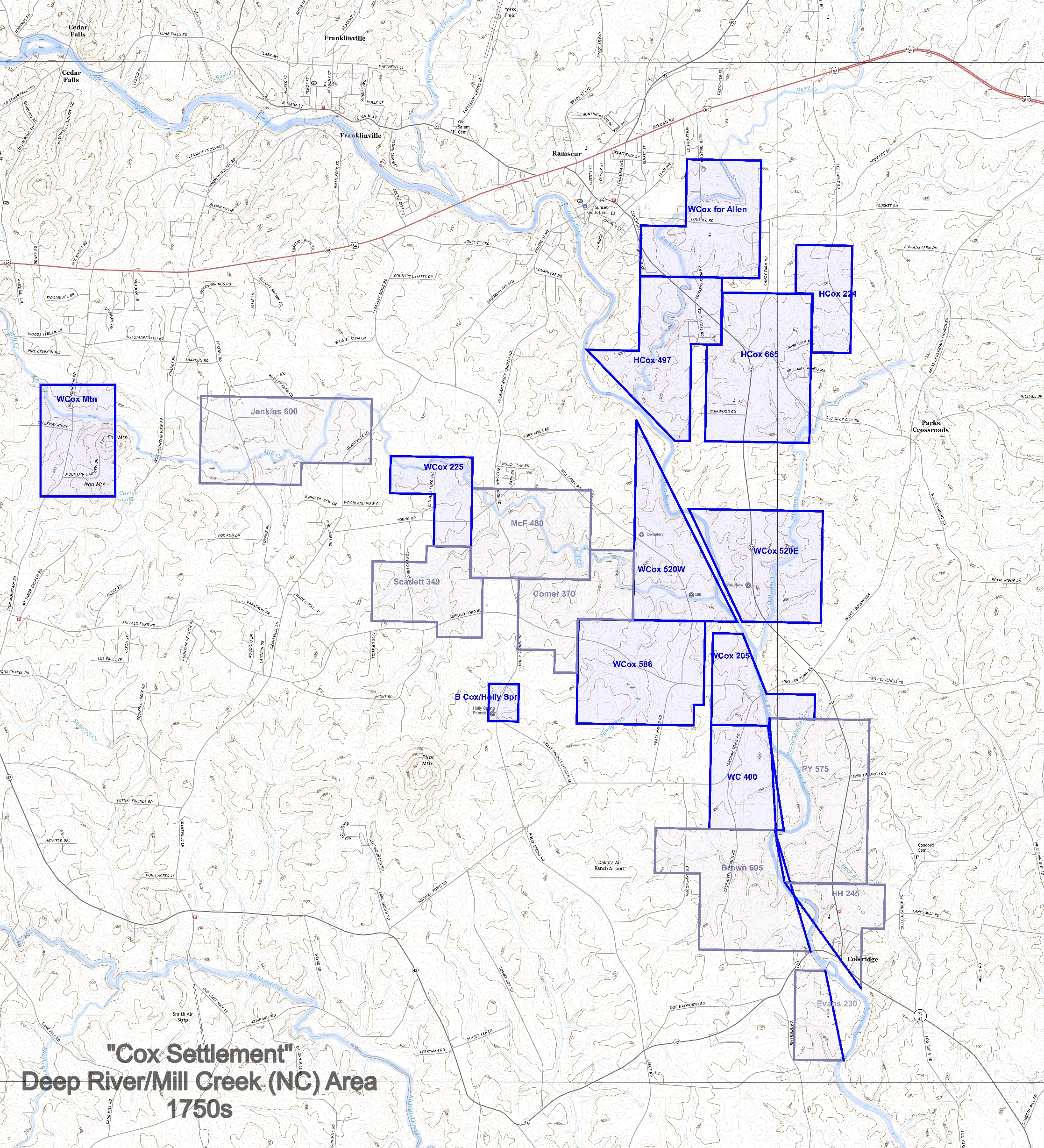
This post provides more detail of the land willed by William Cox (1692-1767) to his sons Harmon, William, John, Solomon, and Thomas. William and his sons acquired several thousand acres along Deep River and its tributaries in southeastern Randolph County, NC during the 1750s. William’s will divided his properties among his sons.
(Click on any image to enlarge).
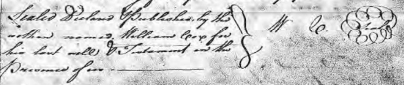
Dated 20th day first month 1767, “proved 2nd Tues Feb 1767.”
In the name of God Amen, I William Cox, of Orange County in the Province of North Carolina, but being weak in Body but in perfect senses, praised be God, Do make this my last will & testament.
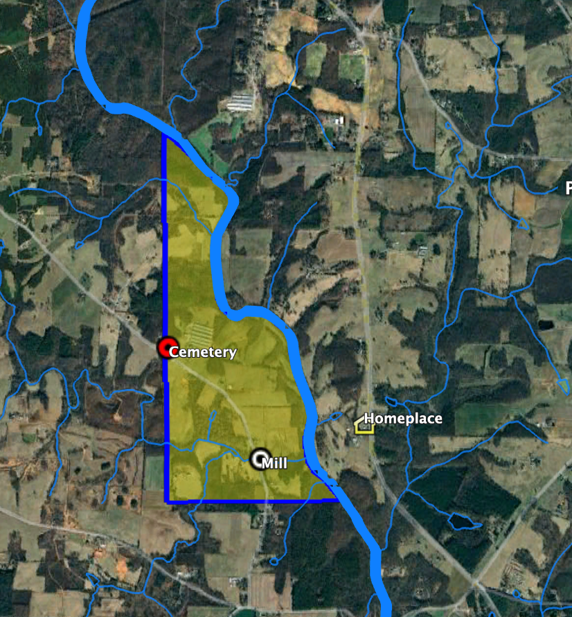
Imprimis, I give to my son Harmon Cox, that whole tract of Land on the East side of Deep River whereon he now lives to him & his heirs forever.
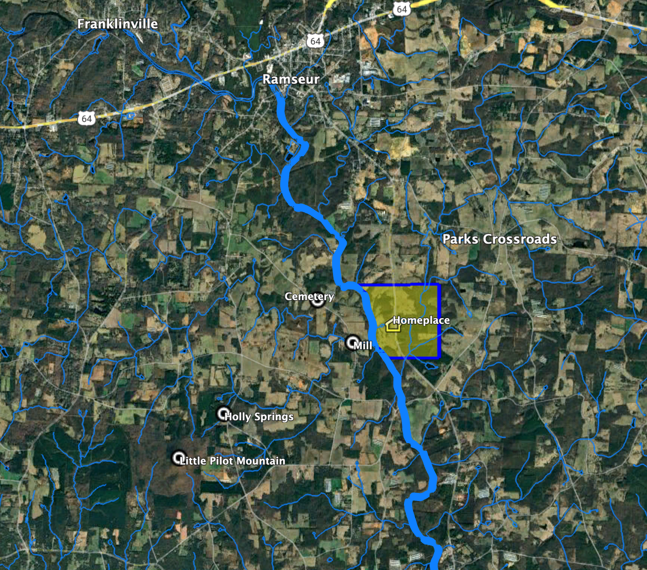
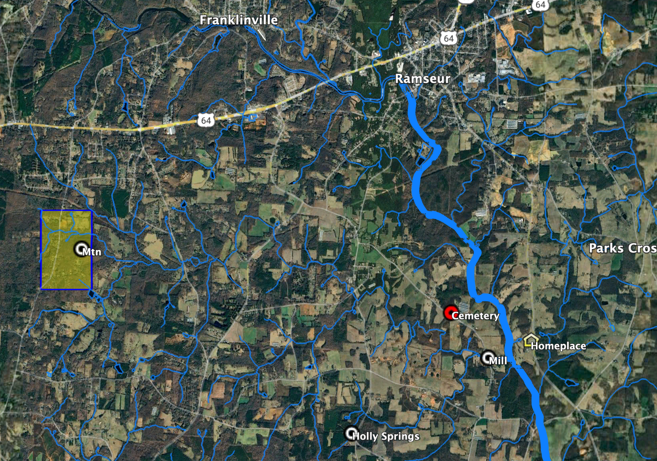
This is the 520-acre Granville grant secured by William in 1754. This parcel includes my cousin Emily Johnson’s house on NC Hwy 22 south of Ramseur that the family refers to as the “home place.” Before researching the specific grants, I assumed the home place was located on land acquired by Harmon. That was the family lore. Harmon’s inheritance of this land (“where he now lives”) is likely why the family considered Harmon the original owner. Much of this land is still held by Harmon’s descendants.

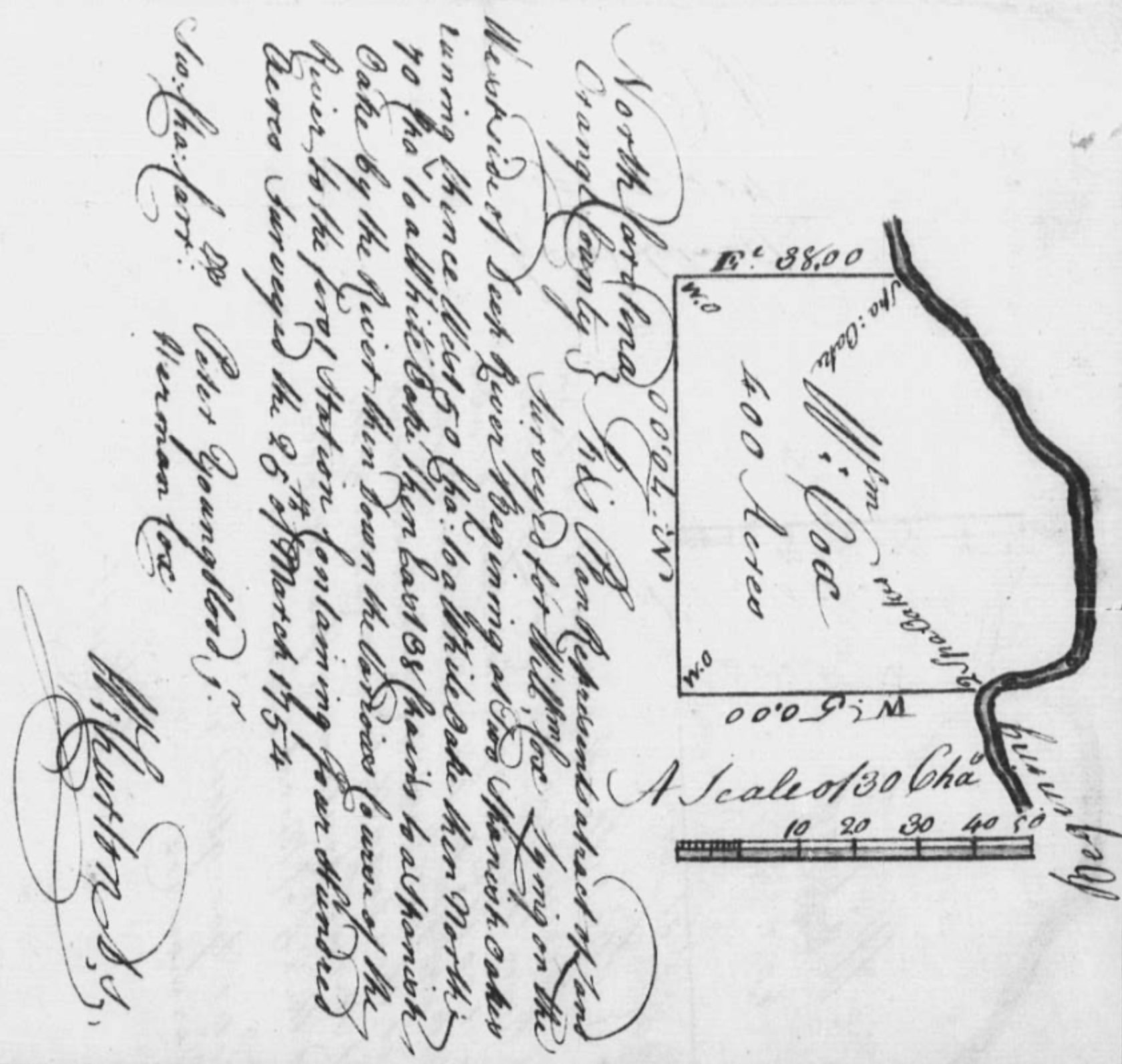
Item. I give to my son William Cox that whole tract of Land called the Thickett on the west side of Deep River to him & his Heirs forever.
I believe this is the 400-acre grant. In a subsequent transfer of the 205-acre grant to the north, it is described as being “adj. Mill Tract, William Cox, the Thicket, Peter Youngblood, Harmon Cox.”
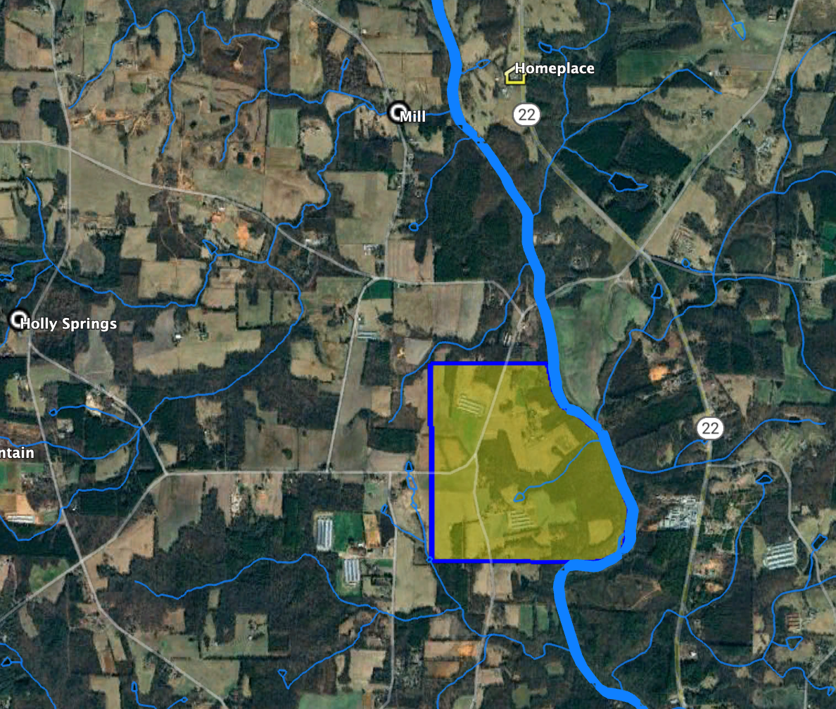


Item, I give to my son John Cox part of the tract of Land I now live on, Beginning for the Division between him & my son Thomas at a Sycamore or Button wood tree on the River bank a little below my fence marked with three notches on the West side of the River front, thence Running West till it comes to a Hollow Leading down to the Mill Creek, thence Down the said Hollow about twenty poles to the Mill Creek, thence up & with the Creek till it Entersect a West line, thence along the line North to the River, thence Down the River to the Beginning, and also that Whole tract of Land lying on the Mill Creek containing two Hundred & twenty five acres, above William McFarsons Land, both which Pieces of Land I give unto my said son John to him & his heirs forever.
Let’s break this into two parts. The 225-acre tract “above William McFarson’s land” is easy to determine. This is the grant acquired in 1755 to the west of Deep River on both sides of a section of Mill Creek (“lying in the Mill Creek”). It is just off today’s Pleasant Ridge Road, and a there are several Cox descendants living on parcels that were once part of the larger grant.

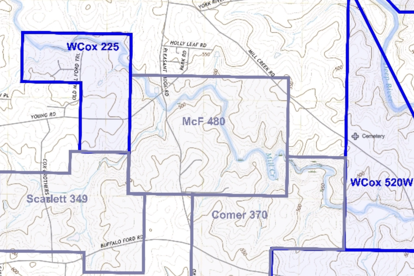
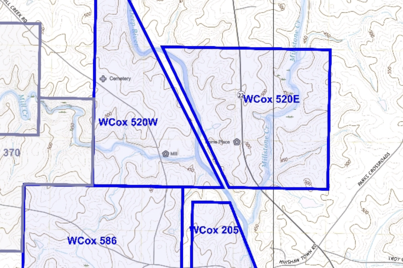
As for the property to be divided between John and Thomas (described by William as the “tract of land I now live on”), there’s little doubt this is the 520 acres west of Deep River secured through a 1754 grant. It’s a little confusing to interpret the references to fences and hollows, but the gist is John got land to the north of Mill Creek and, presumably, Thomas received the land on and south of the creek as we know he operated the mill at the time of William’s death, and in a subsequent item William writes more specifically about the “lower end.”


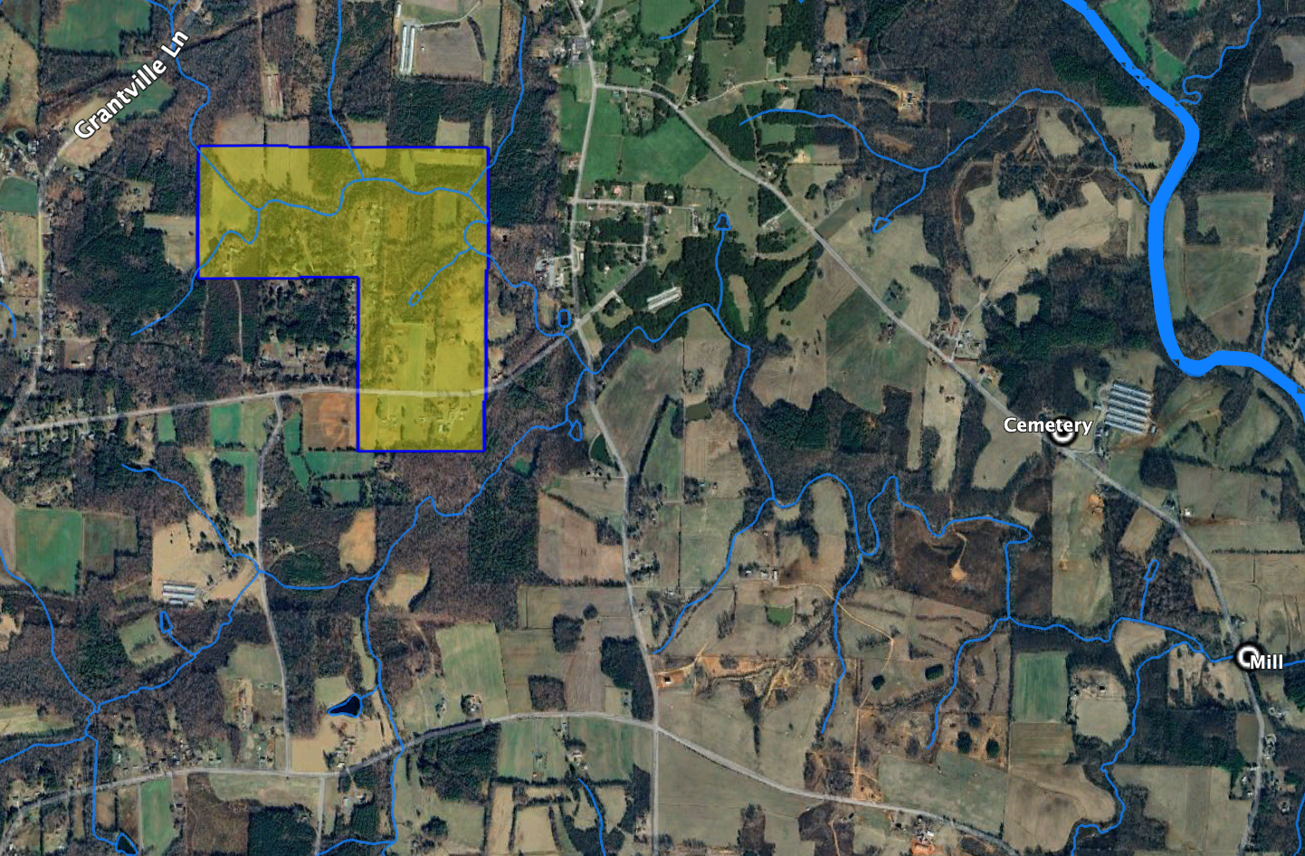
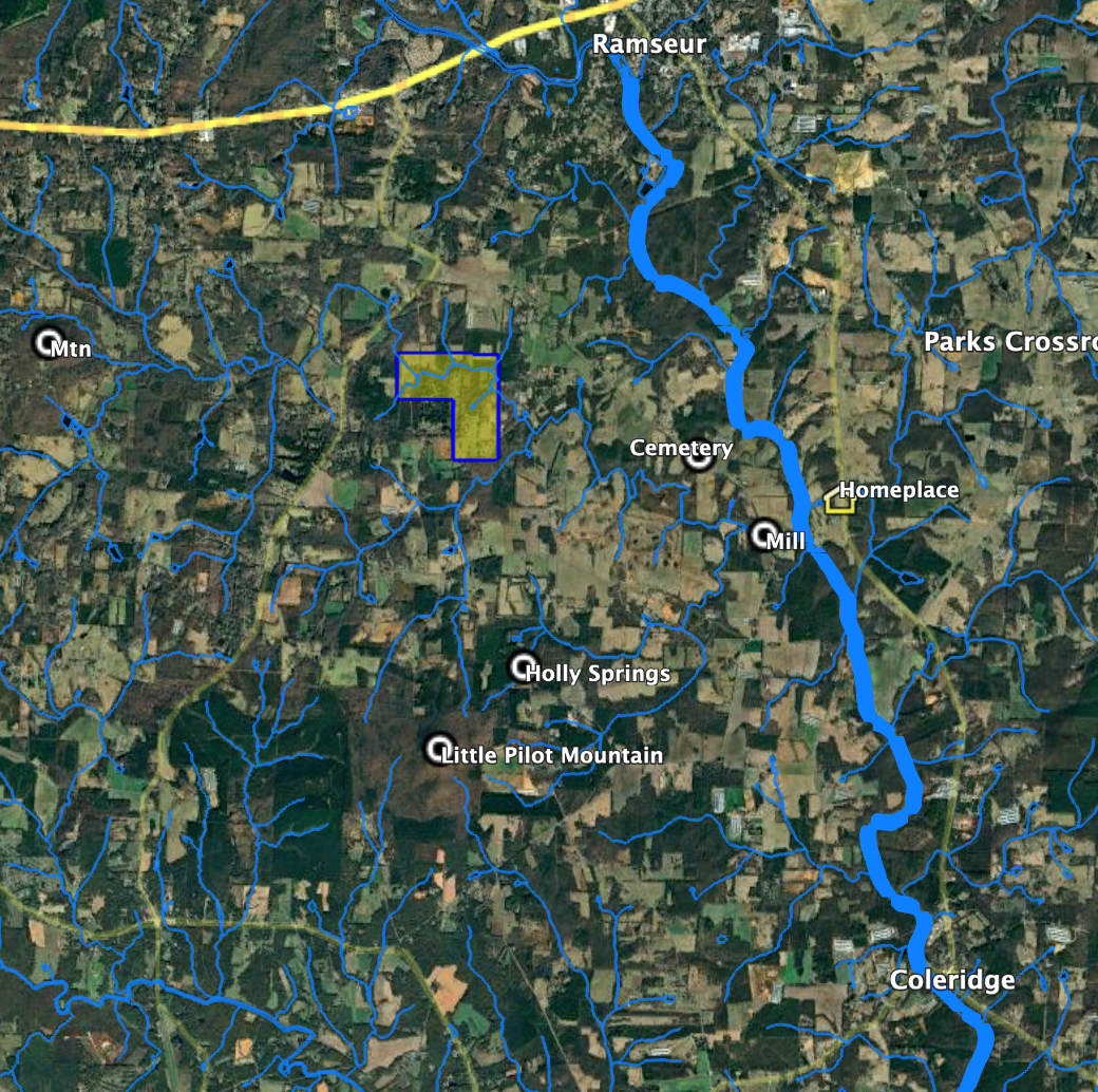
Item. I give to my son Solomon Cox that whole tract of Land lying on little Brush Creek where Benjamin Williams formerly lived, where my son Solomon now lives to him & his heirs forever.
This is the 487-acre parcel acquired via a 1755 grant. It is east of the scope of the Cox Settlement map shown, and is near the Randolph and Chatham County line.

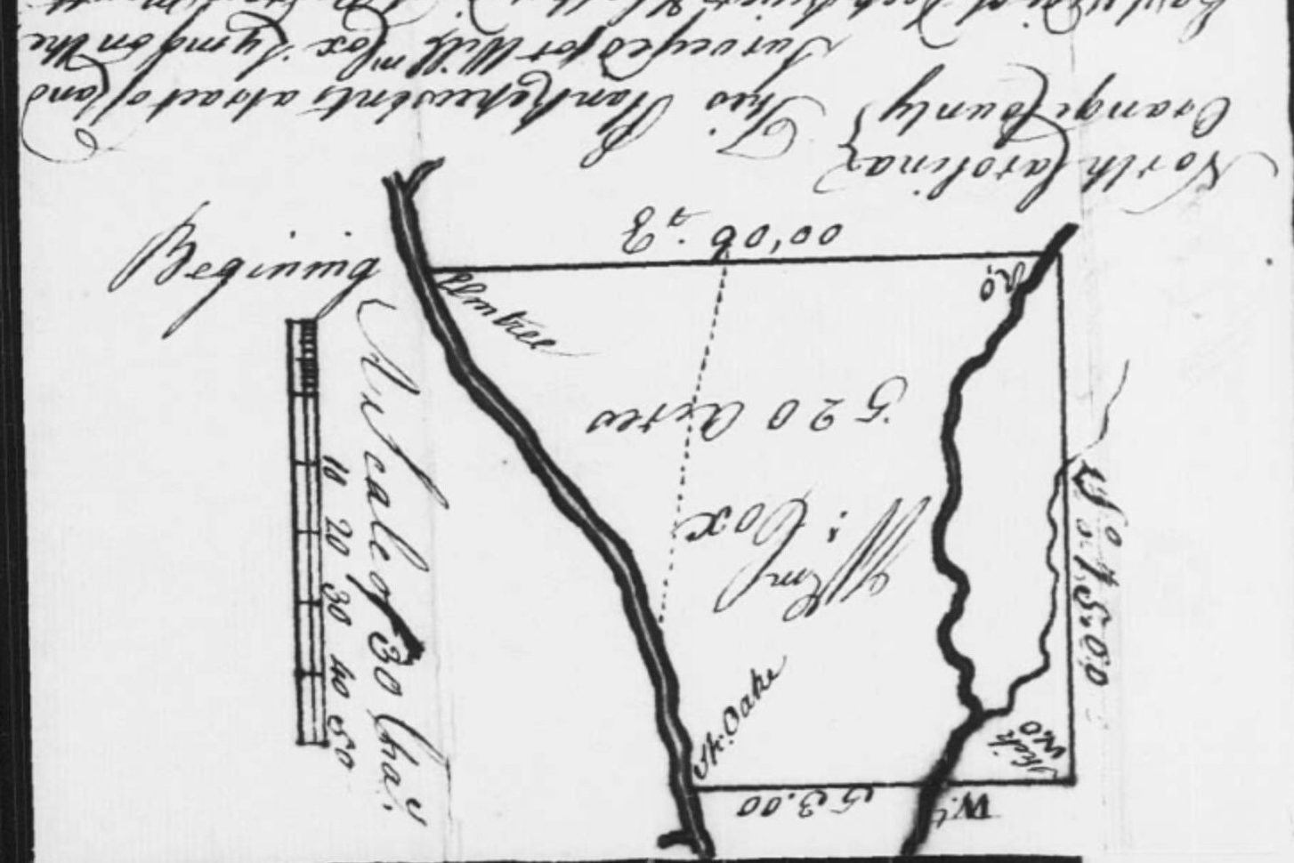
Item. I give to my son Thomas Cox the Remaining part of the aforesaid tract of Land I now live on Divided from my son John by a West line from the Sycamore as aforesaid, having the Lower end including Mills & Improvements thereon and also One hundred and Eighty acres out of the tract my Brothers formerly lived, Beginning at the Original – Beginning W.O. tree Running thence West thirty-five Chains or one hundred and forty poles to the Corner. Thence South fifty five and a half pole, Thence East One hundred and fifty six poles to the line of the whole Tract. Thence North along the said line One hundred and fifteen poles and a half to the first Corner W.O. Thence West two hundred poles to the first beginning, to him & his heirs forever.
The first part of this item concludes the division of the 520-acre tract west of and bounding Deep River by specifying that Thomas inherits the mills on Mill Creek. It would make sense for the additional “one hundred & eighty acres out of the tract my brothers formerly lived” to be a portion of the land south of Mill Creek, the 586 and 205-acre tracts in the accompanying image.

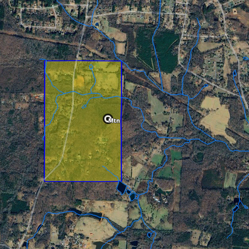
Item. I give to my five sons Harmon, William, John, Solomon and Thomas two tenths of the land and mines and tools Equally Divided, lying on Crawford Road on the Round Mountain to them & their heirs forever.
This is the grant acquired by William in 1756 that secured the headwaters of Mill Creek. The division of the land “equally” among the five sons without additional specificity is interesting. This land is off today’s Iron Mountain Road, named so because the Confederates mined iron ore here during the Civil War.


You must be logged in to post a comment.