
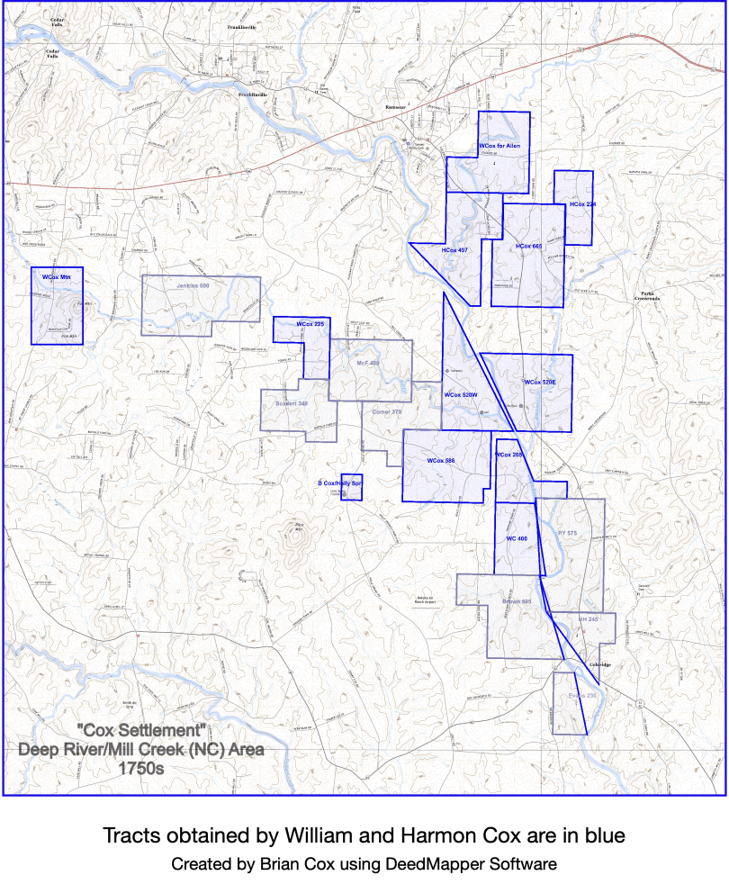
This is a long overdue post regarding an updated map that my west coast cousin Rich Marshall and I are calling “Cox Settlement.” It is a map of the Cox (and related Quaker family) Granville land grants on Deep River and Mill Creek. The map name is taken from references to the area in Cane Creek Friends records of the 1700s..
There are several landmarks of note added to the USGS topo: the location of the mill on Mill Creek, the family cemetery, Holly Springs Friends Meeting, and the “home place” where another cousin, Emily Cox Johnson, still lives. We use these landmarks, Deep River, and its tributaries (particularly where there is a distinct shape) to serve as home base so-to-speak.
We attempt to honor deed references to adjoining corners and boundaries, but default to being consistent with the waterways when there is uncertainty. The rivers are the constant. This leaves some gaps we can’t readily reconcile.
A recent addition is the Jenkins tract. We are reasonably confident it belongs on this “Mill Creek” as the grant references Deep River, and because Jenkins and his chain carriers, Christopher Hussey and Robert Hodgins, are Quakers with family ties to the Coxes.
We don’t include the river area north of Ramseur as Orange County historian Mark Chilton has already mapped a lot of the Herman Husband and Sandy Creek family grants. We also begin losing connection to the core Quaker family group south of Coleridge, and stop there. There are additional grants obtained by the Coxes, Moffits, and other Quaker families to the east and west on Richland and Little Brush Creeks, but not included on this particular map.
We are shopping it among area historians for feedback. Hope you find it interesting!
Sources of note:
