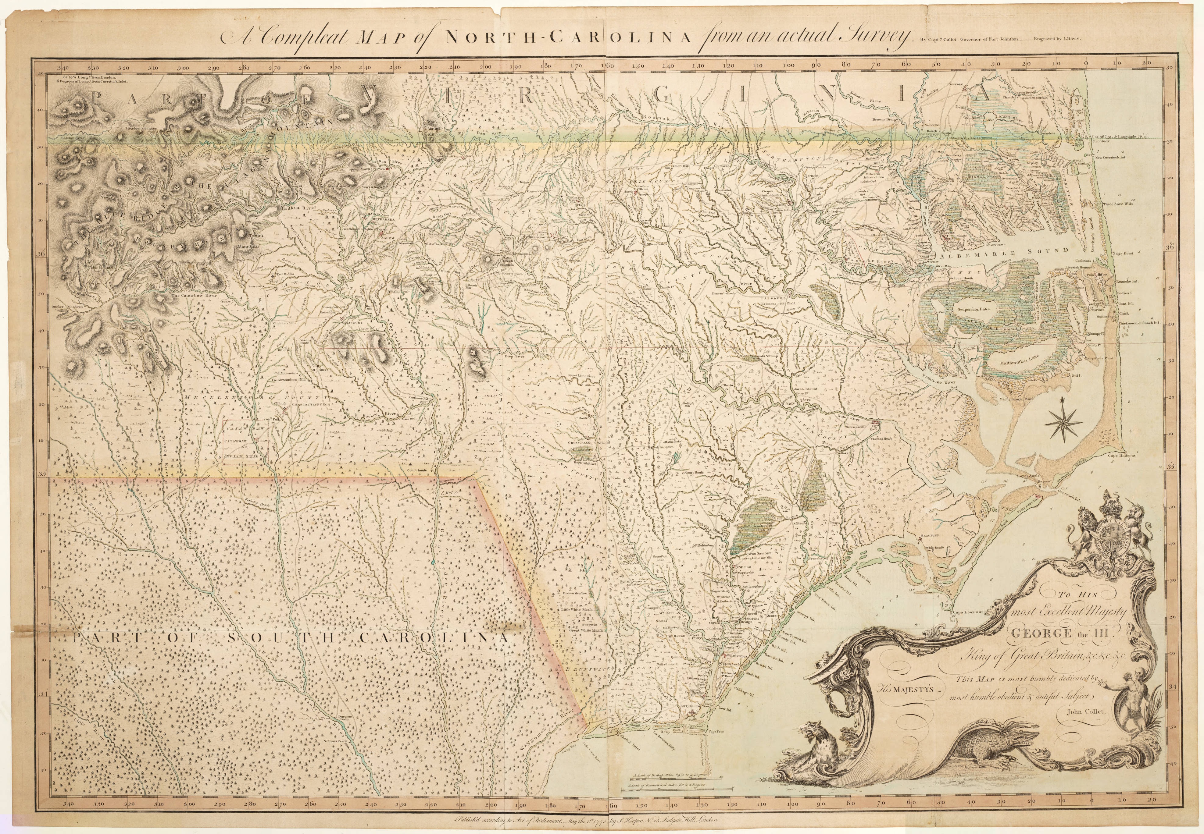
A Compleat map of North-Carolina from an actual survey, John Collet, circa 1770, showing Cox’s Mill.
“A Plan of the Camp and Battle of Alamance, the 16th May 1771, between the Provincials of North Carolina, Commanded by His Excellency Governor Tryon, and Rebels who styled themselves Regulators.” Survey’d and Drawn by C. J. Sauthier.
A map of North & South Carolina: accurately copied from the old maps of James Cook published in 1771, and of Henry Mouzon in 1775, showing Cox’s Mill as “Mill.”
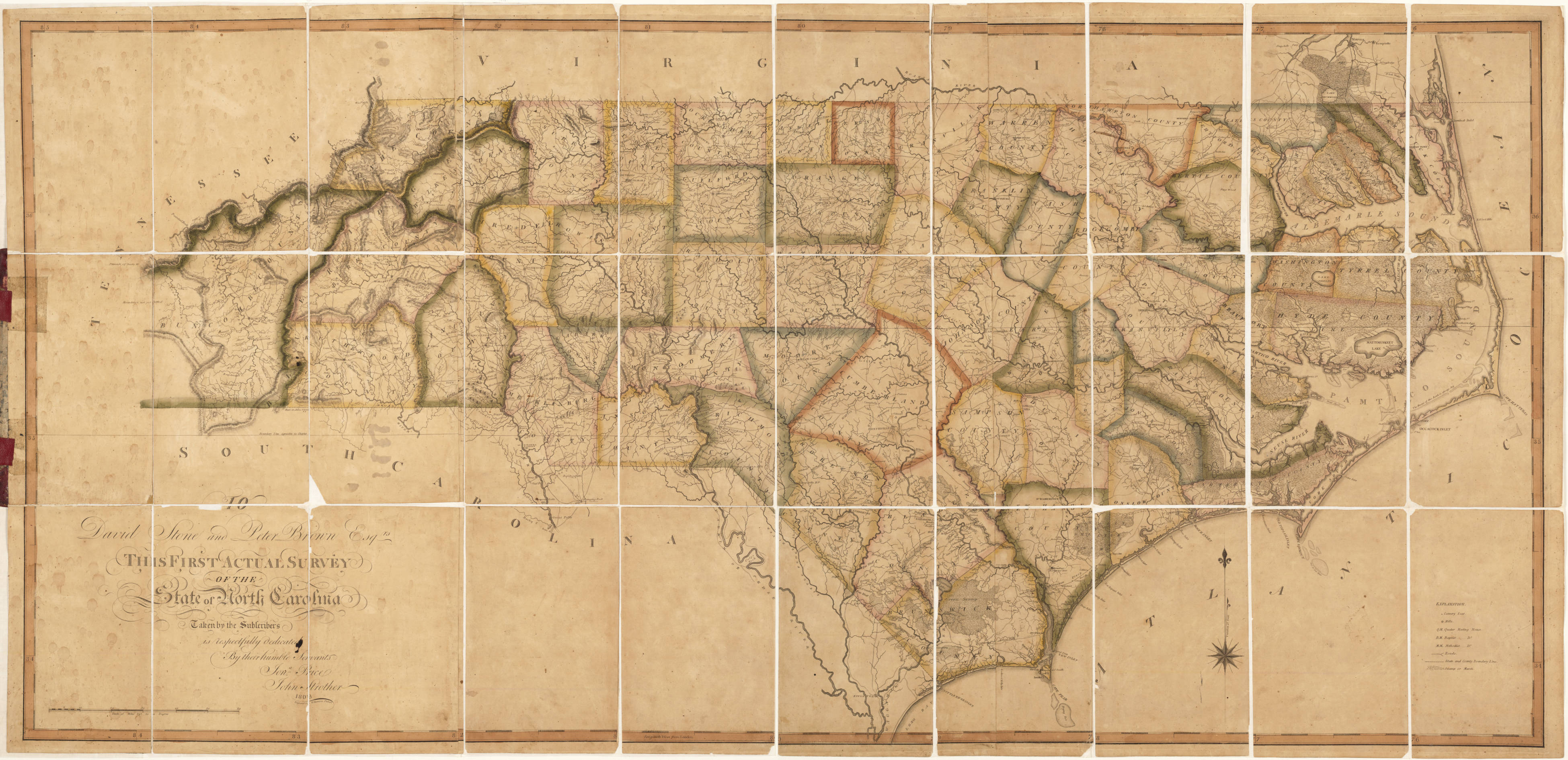
Price-Strother Map, First Actual Survey of North Carolina, circa 1800. Millstone Creek identified, as well as Crawford’s Road/Path.
Map of Chatham County, NC (Nathan Ramsey). circa 1870.
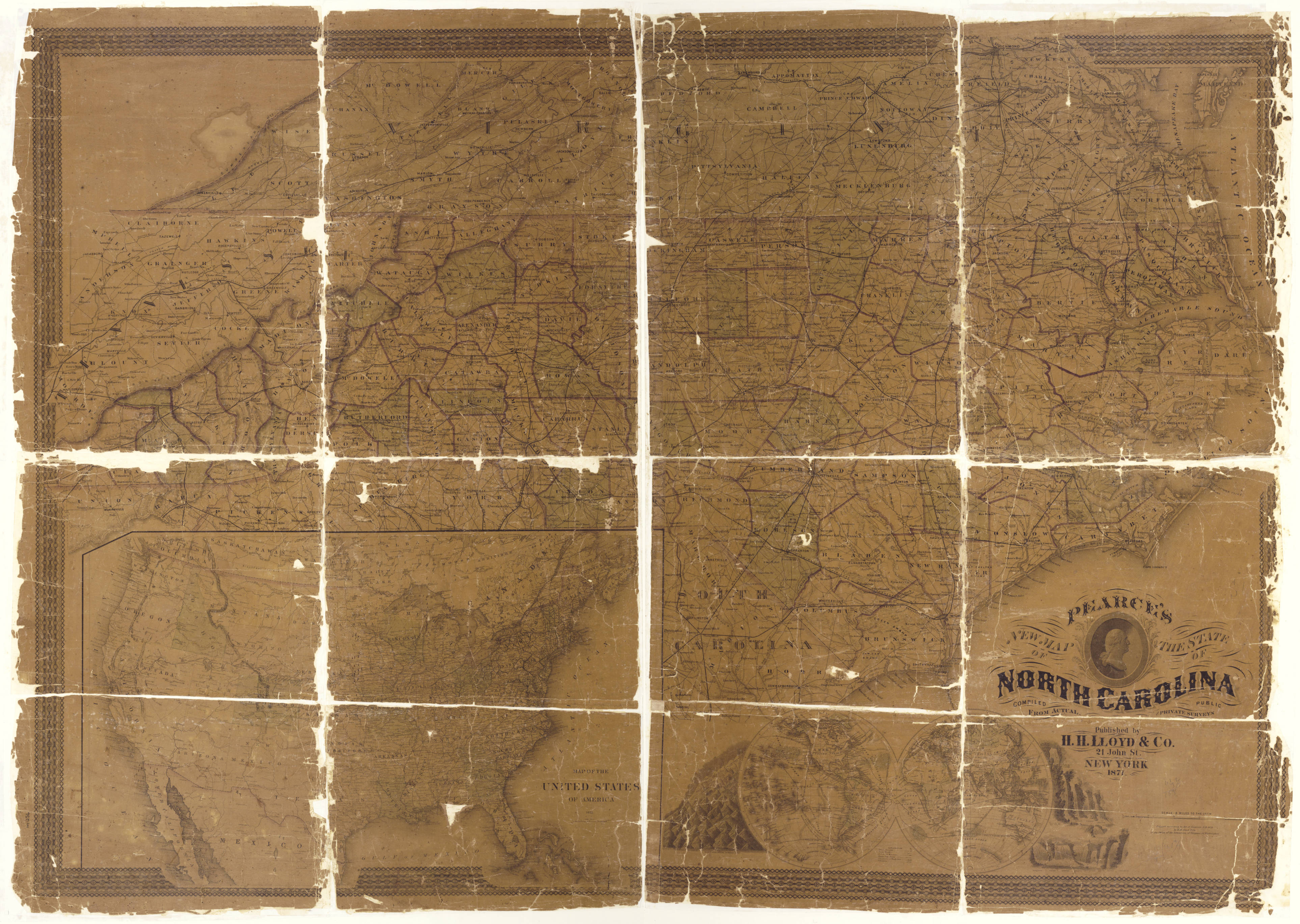
Pearce’s new map of the state of North Carolina, circa 1870 showing “Cox’s Mills.”
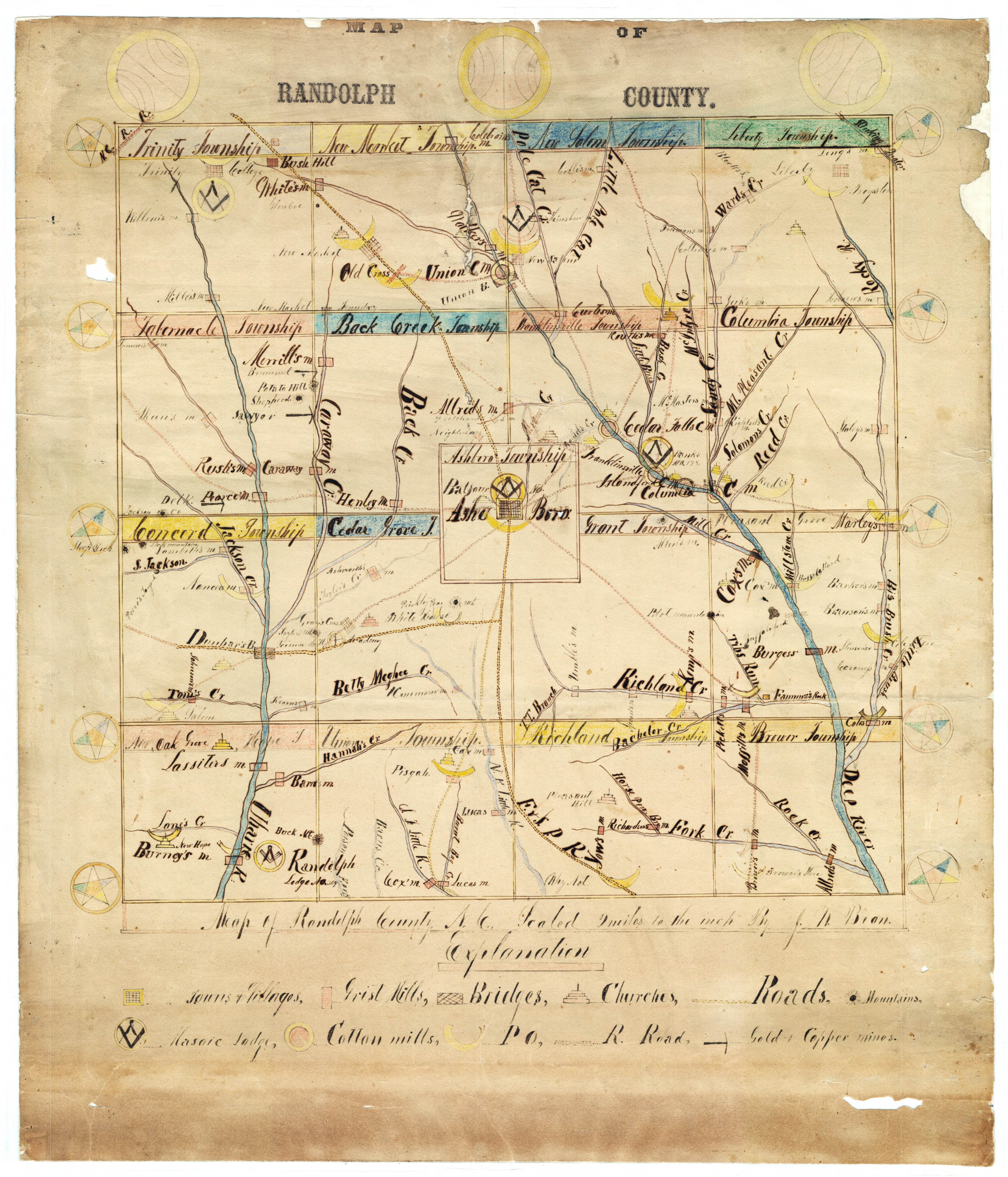
Map of Randolph County, NC (J. W. Bean), circa 1873, with Cox’s Mill identified.
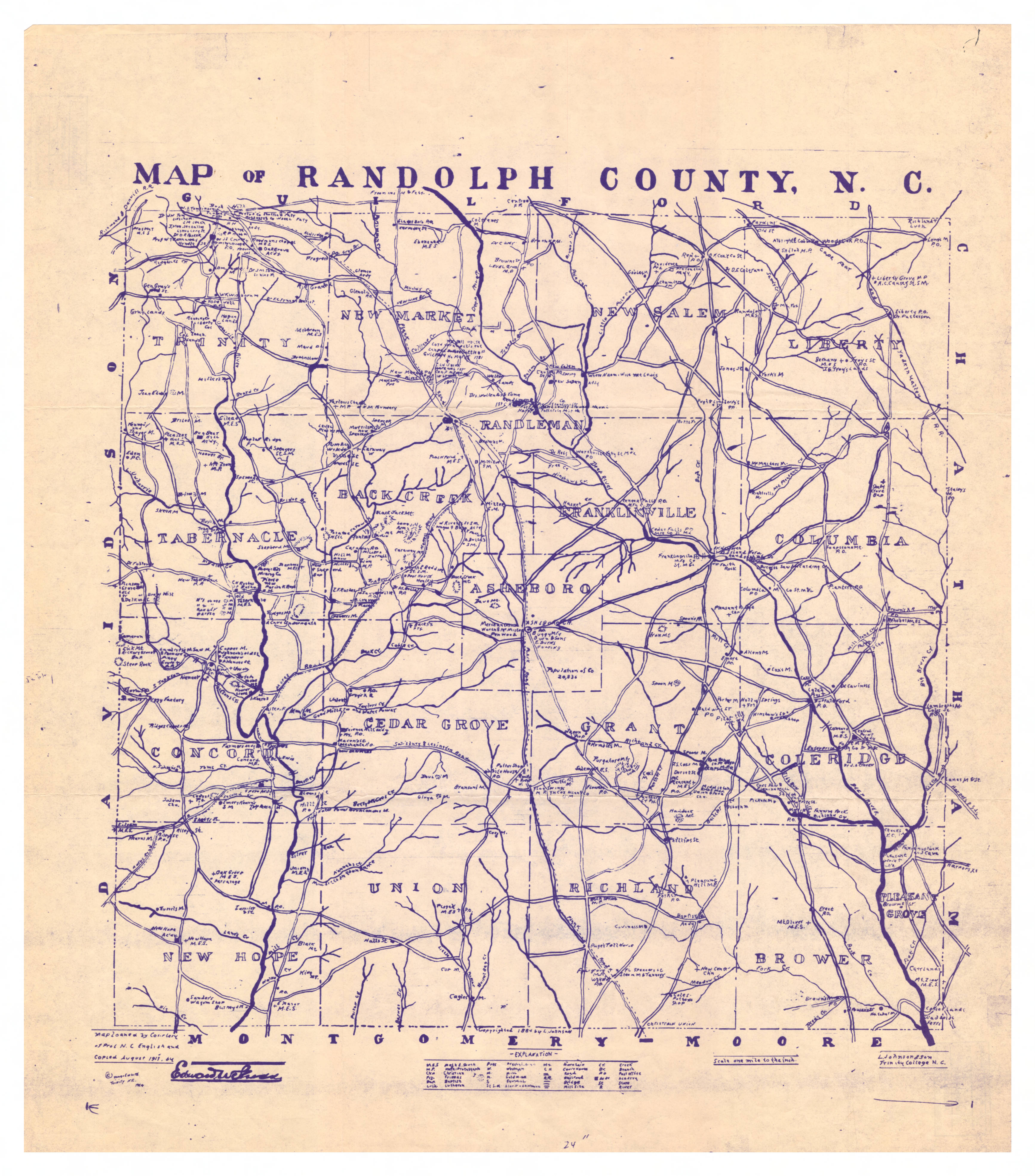
Map of Randolph County, N.C. (L. Johnson), circa 1884, showing two Cox’s mills.
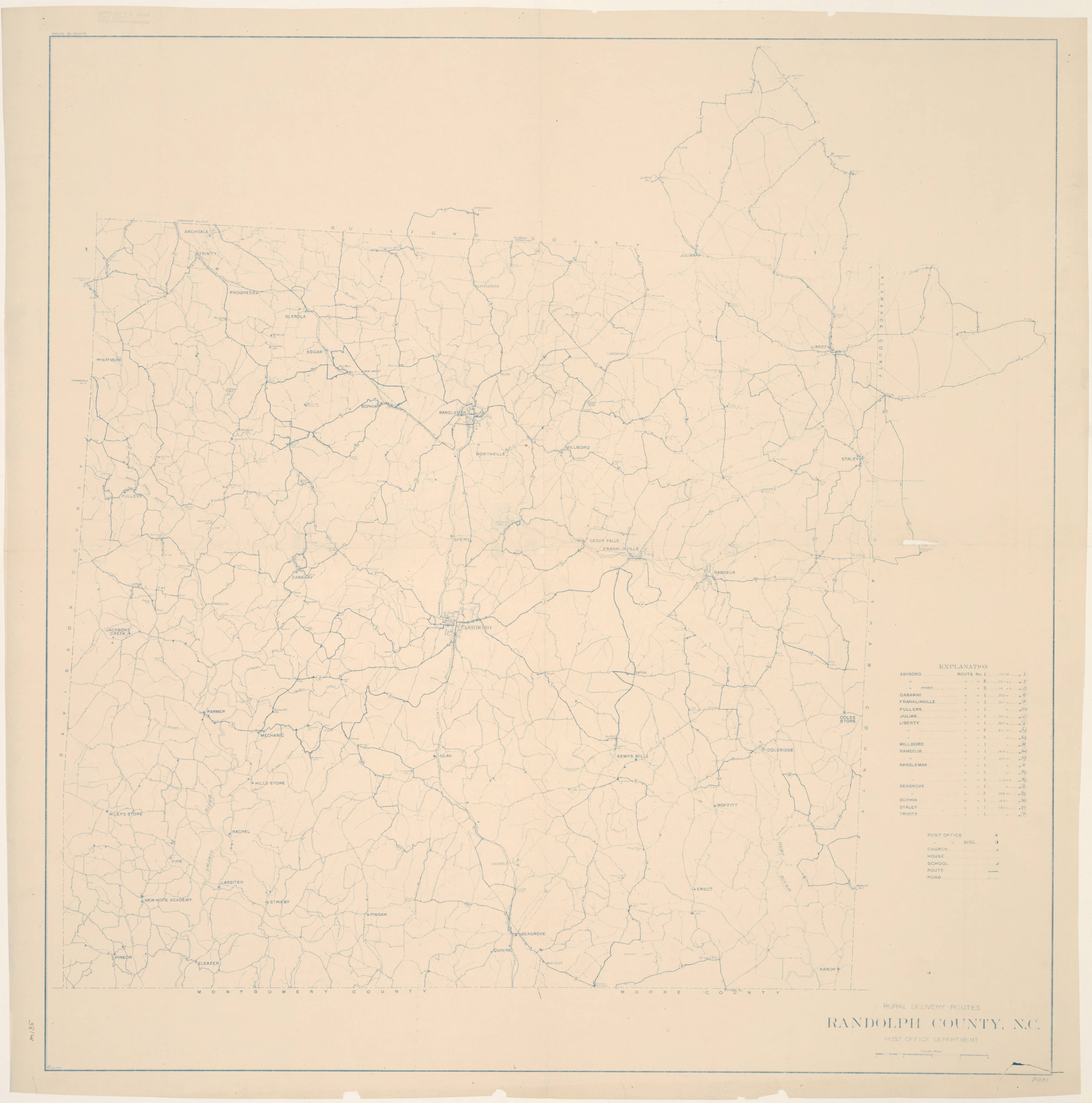
Rural delivery routes, Randolph County, N.C., 1919, showing Cox’s Mill and another point designated only as “Cox.”


You must be logged in to post a comment.